Skip to content

Coalition for San Francisco Neighborhoods

Advocating for a healthy city

  • News
  • Events
    • 2023
    • 2022
    • 2024 Holiday Party
  • Media
  • Organization
  • History
  • Member Organizations
  • Archives
    • Resolutions
    • Letters
  • MAPS
    • Neighborhood Groups
    • At Risk High Rises
  • Newsletters

MAPS

Interactive Re- Zoning SF Map 2025 : https://experience.arcgis.com/experience/6e0e399f9c82456dbda233eacebc433d/

NEIGHBORHOOD GROUPS


download pdf

Download 2022 Citywide Districts pdf

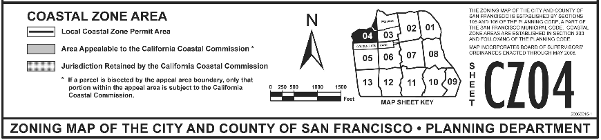
Colored California Coastal Commission Maps and key

10 ft Sea Level rise::

Old CSFN neighborhoods map

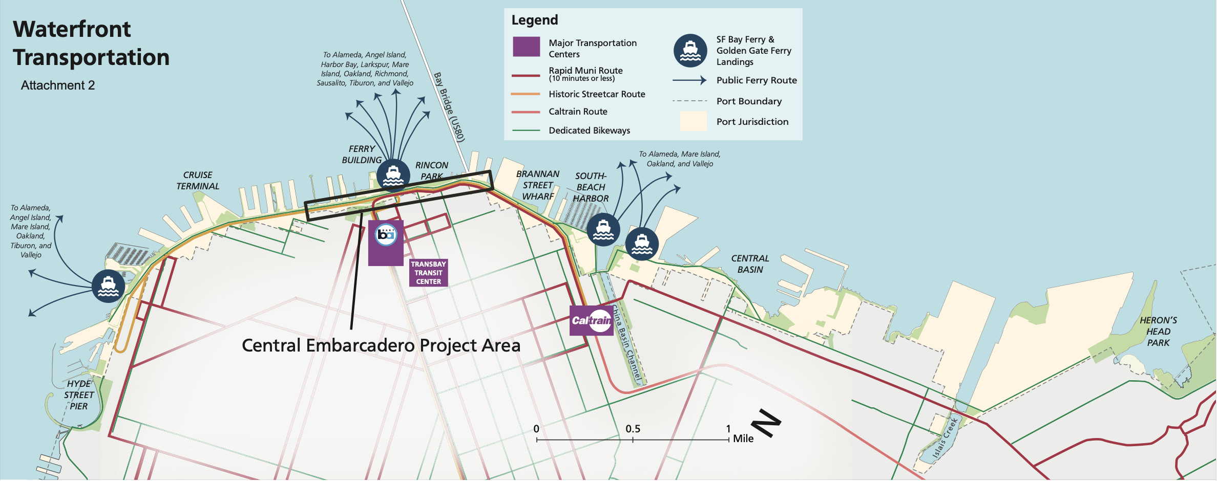
Waterfront Transportation plans

Westside Costal Zone Area Maps

Great Highway Pilot Map

SFMTA Maps of traffic on Sloat 1 and Sloat 2

Contact CSFN:
president@csfn.net
secretary@csfn.net
treasurer@csfn.net
Facebook
Linkedin
@zrants
@CsfnSecret14359
@csfngram

search

Articles

  • NO DAY AT THE ZOO
  • Here’s a map of where SFPD officers work private security side gigs
  • Unprecedented vote shows Dems fractured over housing policy
  • Dozens of Mission homes could gain historic preservation protections
  • S.F. city departments are billing each other millions as city faces down massive deficit
  • Notice Ordinance Passed
  • ABUNDANCE MEETS RESISTANCE: ARE DEMOCRATS FINALLY READY TO GO ALL IN ON BUILDING HOUSING?
  • Supes approve public notice for neighborhood zoning changes

Meta

  • Register
  • Log in
  • Entries feed
  • Comments feed
  • WordPress.org
  • Facebook
  • Linkedin
  • Email
  • zrants
  • CSFSecret14359
  • csfngram
Proudly powered by WordPress